The London Underground (Tube)
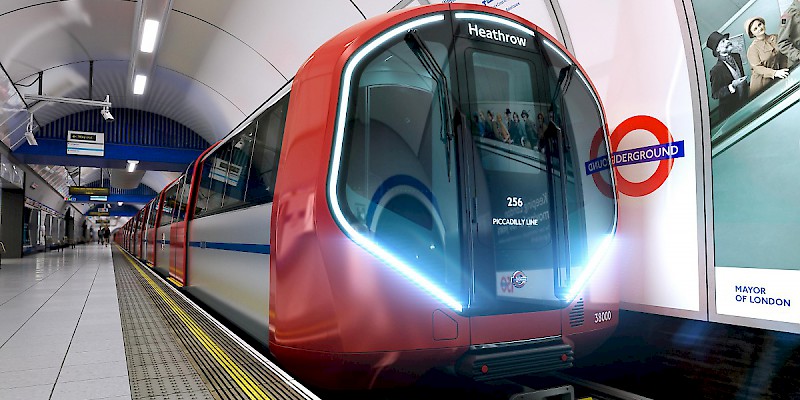
The mighty Tube, or Underground, is London's subway system
The quickest and most popular way to get around town is the London Underground, known locally as The Tube.
This is London’s subway system (although in British the word “subway” means “pedestrian underpass”).
The Underground is a complex network of lines and interchanges that make getting anywhere in London easy—though do expect to change trains on probably half your journeys.
How much does a ticket on the London Tube cost?
As with all public transport in London, the amount you pay varies on the time of day (peak vs. off-peak), distance traveled (zones), and method of payment.
In general, for travel within Zones 1 and 2 (covering 99% of the London most visitors use), a ride on the Tube costs:
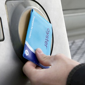
- £2.30–£2.90: Oyster Card; daily price cap: £6.40 (best for stays of1–4 days)
- £32.10: Unlimited-ride 7-day Travelcard; (best for stays of 5+ days)
- £4.80: Single ticket
- £5–£10/day: London Pass Travelcard
As you can see above, you should never, ever buy an individual ticket; you can save more than 50% just by picking up an Oyster Card and using that.
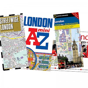
How do I get a map of the London Underground?
Grab yourself a copy of the famous map of the Underground system, instantly recognizable for the Absolute-bottle-on-its-side silhouette of the yellow Circle line—which pretty much proscribes the parts of London in which most visitors spend the vast majority of their time.
(Note: This resemblance to a famous 1980-90s Absolut ad campaign is unintentional; The map's design dates way back to 1931.)
There are free pamphlets featuring the map everywhere at Tube stations (and in most London guidebooks)—or download a PDF of the Tube map from TFL directly to your phone. (You can also get a download link by texting "Tubemap"—without the quotation marks— to tel. 60835.)
DLR and London Overground trains
There are also two light rail networks that, while technically separate systems, are for all intents and purposes part of the vast Tube system, as they interconnect with it and use the same tickets and passes.
The Docklands Light Rail, or DLR, (indicated by parallel aqua lines on the Tube map) is a network of trains that covers much of London's East End, venturing into Central London at to link up with the Tube at the Bank-Monument interchange (you might use it when visiting Greenwich).
The London Overground train (double orange lines on the Tube map) makes a few shaky loops around Greater London—areas where, frankly, few visitors ever venture.
- Tfl.gov.uk - Covers pretty much all London transportation, including the Tube and buses but also taxis, the DLR and other local light rail systems, trams, the London bike share program, and other one-off transport options.
- Nationalrail.co.uk - Covers all of the lines once operated by the (since-privitized) old British Rail. This includes most major British railways, but notably does not cover many urban area light rail systems (such as London, Glasgow, Manchester, Blackpool, Sheffield, and Midland Metro), nor does it cover the Eurostar, Heathrow Express, nor a handful of heritage or privately owned railways. Still, it's the closest thing to one-stop shopping for finding train connections across the mainland U.K. (though not Northern Ireland).
Tips
To calculate rough travel time, count on an average of three minutes between Tube stops, three minutes to make a transfer, and 5 minutes waiting for a train.
I love the London Underground, but sometimes it makes me feel like a gopher, spending all my time tunneling under the city, popping up merely to walk a bock or two to my destination, then scurrying back underground to tunnel off to the next stop.
Every once in a while, take the bus instead (or even—gasp!—walk). You'll get to see London street life as you go—and get a better feel for the layout of the city.
You'll often find that two stops on the Tube—sometimes even stops on different lines—are, in reality, mere blocks apart and easily walkable.
See, the iconic London Underground map does not reflect the true layoutof the city above.
Yes, it is a masterpiece of graphic design—a classic—but as a "map" it is excessively stylized, with the actual distances often mightily stretched or compressed so as to make room for all the labels and stations. (Calling it a "diagram" instead of a "map" might make it a bit less misleading.)
The Underground map is eminently readable, but the map reflects neither the actual routes of the lines (the Circle line does not, in fact, describe a perfect "Absolute bottle" shape), nor the true distances between stops.
In Britain, a "subway" sign indicates a pedestrian tunnel that goes under a busy street. Unlike in America, subway is not a synonym for the local urban underground train system (though Londoners usually know that we Yanks are referring to the Tube when we mistakenly say "subway").
In other words, you can take the subway to get to the Tube, but you can't take a ride on the subway. Got it?


